Nature and Culture Trail Hamnskogen
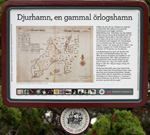
Djurö Harbour
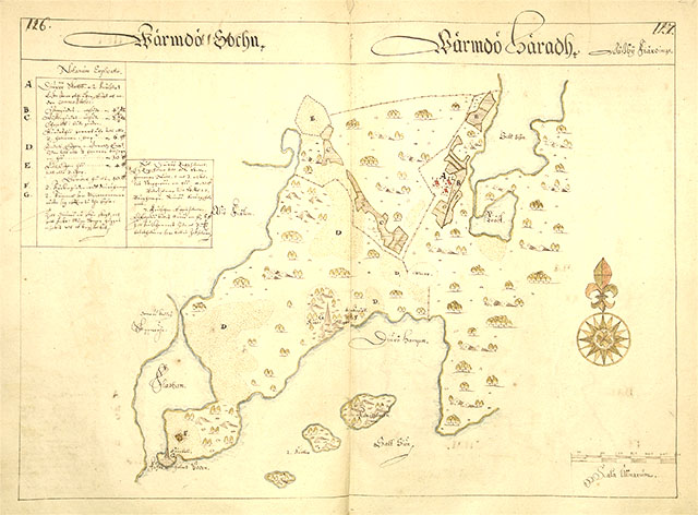
The headland where you’re standing was formerly a separate island. To your right (to the west on the map) you can see a long, sheltered inlet. This is present-day Hamnviken, which from the end of the 15th century until a little while into the 18th century was a well-known anchorage for warships and merchantmen. Ships could wait for weeks here for a favourable wind or guard the entrance to the sea-lane to Vaxholm and Stockholm.
The phenomenon of Post-arctic rebound has caused the land to rise. Here, in the Stockholm region this has been going on at a rate of roughly 40 cm each century. So when the bay was used by the war fleet the water level was a couple of metres higher than today and reached in a long way to where there are now meadows, forest and buildings.
On the map here, showing Djurö in about 1640, you can sense the importance of the harbour. Right out on the point there’s a sea mark, a so-called sea-cairn. There’s another one further in in the harbour. There’s a note on the map explaining that they are there “for pilots to follow when sailing”.

